
| Method | Copper engraved |
| Artist | Kitchin, Thomas |
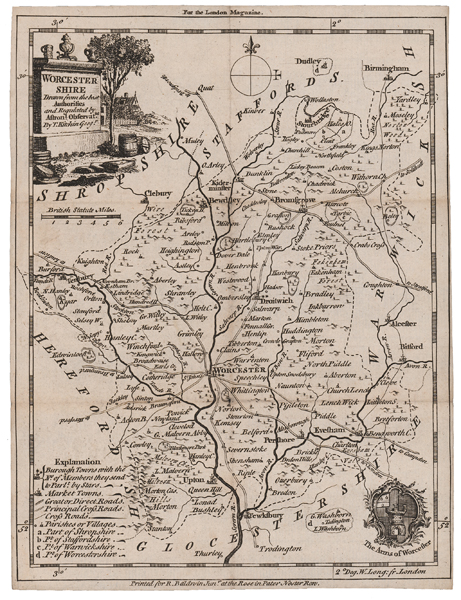
| Published | By T. Kitchin Geogr. For the London Magazine. Printed for R. Baldwin Junr. at the Rose in Pater Noster Row. [London, c.1752] |
| Dimensions | 220 x 167 mm |
| Notes |
An attractive mid-eighteenth century map of the county of Worcestershire, engraved by Kitchin for the London Magazine and Monthly Chronologer. A key in the bottom left provides details of Borough Towns, Market Towns, the road network, parishes, and villages. In the top left, the title is enclosed in a monumental cartouche, and the arms of Worcester are included in the bottom right corner of the plate. Thomas Kitchin (1718-1784) was one of the best and most prolific engravers of the eighteenth century. He issued The General Atlas, Describing the Whole Universe , first published in 1773, and regularly reissued thereafter. His work also included a large number of maps of the English counties, particularly for the London Magazine (1747-1760), the Universal Magazine (1747-1766), and for Dodsley's England Illustrated (1764). Other maps were published in conjunction with Emanuel Bowen in the Large English Atlas and the Royal English Atlas (1763). Condition: Vertical and horizontal folds, as issued. Minor dirt-staining to folds. Manuscript title in old hand on verso, otherwise blank. |
| Framing | unmounted |
| Price | £60.00 |
| Stock ID | 51526 |