
| Method | Copper engraved with hand colour |
| Artist | Moll, Herman |
| Published | [London, c.1723] |
| Dimensions | 150 x 490 mm |
| Notes |
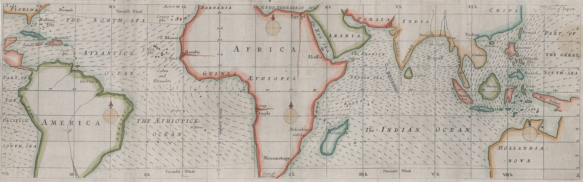
A rare early eighteenth century map of the tropics, showing the prevailing winds of the Atlantic, Indian, and Pacific oceans, engraved by Herman Moll for later editions of The Compleat Geographer: or, the Chorography and Topography of all the known Parts of the Earth.' The map, in a much rougher style than was customary for Moll's maps, is centred on Africa, and stretches from Florida and Mexico in the West to New Guinea and the unmapped coast of New Holland, modern Australia, in the East. Coastlines are picked out in hand colour, but otherwise, the individual nations of the southern Americas, Africa, the Arabian peninsula, southern Asia, and Australasia are shown in relatively simple detail, with text labels limited to simple national and regional names. The map was engraved as a companion to Moll's description in Chapter 5 of The Winds, and as such the main focus of the map are the directions of the trade winds of the tropics, as well as the associated paths of calms and tornados. Dotted lines close to the top and bottom of the map mark the change to temperate regions of variable winds. Although the Atlantic and Indian oceans are shown in full, the Pacific is only shown in part, at the westernmost extreme of the map, and in the form of the 'Great South Sea' east of Japan. Herman Moll (c.1654-1732) was born in Germany and came to England in the 1670s. He worked as an independent cartographer and geographer, and traded as a map publisher and seller for two years, and then worked for other publishers. Moll established his own business and eventually dominated the early eighteenth century map trade. He produced many maps and atlases of England, Wales, Scotland and Ireland. His county maps were all boldly engraved in a heavy style. Moll was also an active member in academic and intellectual circles, being a close associate of Daniel Defoe, Robert Boyle, Robert Hooke, and, most importantly for his cartographic career, the pre-eminent English explorer of the era, William Dampier. Condition: Vertical folds, as issued. Trimmed close to neatline on left margin, as issued. Minor staining and creasing to map. Blank on verso. |
| Framing | unmounted |
| Price | £250.00 |
| Stock ID | 52038 |