
| Method | Copper engraved with original hand colour |
| Artist | Blaeu, Willem Janszoon |
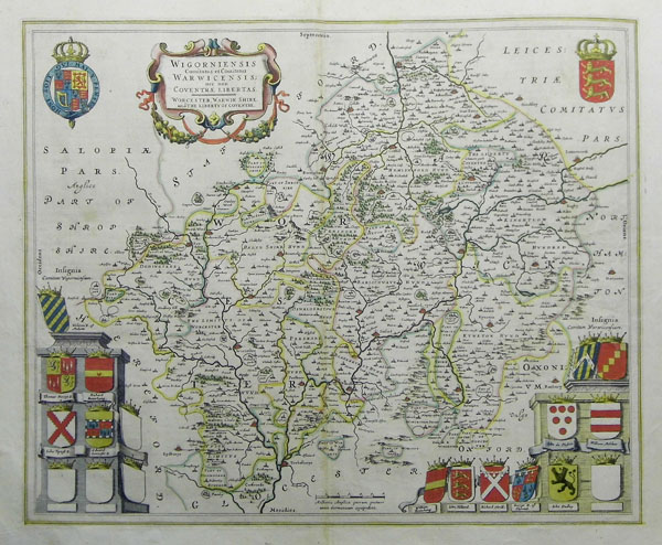
| Published | c.1645 |
| Dimensions | 410 x 500 mm |
| Notes |
A highly decorative map of Worcestershire and Warwickshire with an elaborate cartouche and numerous crests. Latin text on verso. The Blaeu family were one of the most famous publishers of maps, globes and atlases during the sixteenth-century. Cartographers, globe makers and booksellers, the Blaeu business flourished in Amsterdam for over 40 years, until a fire destroyed their premises in 1672. They lost all of their plates, prints and stock, which effectively ruined the firm. Willem Blaeu founded the business in 1596. It initially functioned as a globe and instrument makers, but soon expanded into maps, topography and sea charts. The Atlas Novus was Willems great work; a major work which intended to include the most up-to-date maps of the entire world. He issued the first two volumes in 1635, but died in 1638 before the atlas was completed. The running of the business was passed on to his sons Johannes and Cornelius, in addition to the role of the official cartographer of the East India Company. After the death of Cornelis in 1644, Johannes continued the business alone and established his own reputation as a great mapmaker. Johannes completed his father's grand project in 1655 with the sixth and final volume of the Atlas Novus. He also produced the Tooneel der Steden van der Vereenighde Nederlanden in 1649-1653, as well as a similar set of Italian town plans which were published in 1663. Condition: Centrefold as issued. |
| Framing | unmounted |
| Price | £450.00 |
| Stock ID | 32228 |