
| Method | Steel engraved with hand colour |
| Artist | Fullarton, Archibald & Co. |
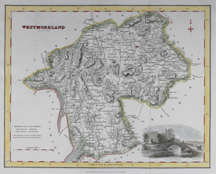
| Published | Published by Archd. Fullarton & Co. Glasgow [c.1830] |
| Dimensions | 195 x 243 mm |
| Notes |
A detailed and decorative map of the county of Westmoreland with vignette view of Brough Castle in the bottom right corner. Archibald Fullarton and Company were a Glasgow based publisher operating towards the end of the nineteenth-century. The company produced a number of atlases, and books containing maps, including Fullarton's Parliamentary Gazetteer Of England And Wales and The Royal Illustrated Atlas, Of Modern Geography . These publications featured attractively decorated maps, with small vignette views of local interest surrounding the engraved map. Condition: Vertical folds as issued. Minor creasing to folds. Blank on verso. |
| Framing | unmounted |
| Price | £45.00 |
| Stock ID | 51256 |