
| Method | Steel engraved with hand colour |
| Artist | Fullarton, Archibald & Co. |
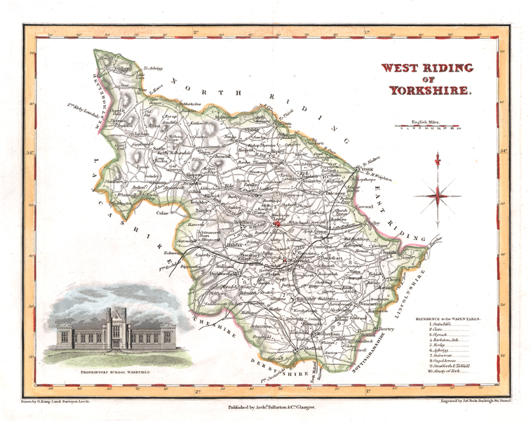
| Published | Drawn by G. Kemp Land Surveyor, Leeds. Engraved by Ja. Neele Burleigh Str. Strand. Pubd. by Archd. Fullarton & Co. Glasgow [c.1830] |
| Dimensions | 190 x 240 mm |
| Notes |
A detailed and decorative map of the West Riding of Yorkshire, showing the Wapentakes, towns and villages, and the railways. A vignette of the West Riding Proprietary School, Wakefield, is included in the bottom left corner. Archibald Fullarton and Company were a Glasgow based publisher operating towards the end of the nineteenth-century. The company produced a number of atlases, and books containing maps, including Fullarton's Parliamentary Gazetteer Of England And Wales and The Royal Illustrated Atlas, Of Modern Geography. These publications featured attractively decorated maps, with small vignette views of local interest surrounding the engraved map. James Neele (1791-1868) was a British printmaker and publisher. He was the son of Samuel John Neele (1758-1824) who was the head of a family of engravers and publishers mainly working from 352 Strand, London. He published several works together with his father from 1816 to 1824 as "Neele and Son". Condition: Central vertical fold, as issued. Blank on verso. |
| Framing | unmounted |
| Price | £55.00 |
| Stock ID | 51435 |