
| Method | Copper engraved with hand colour |
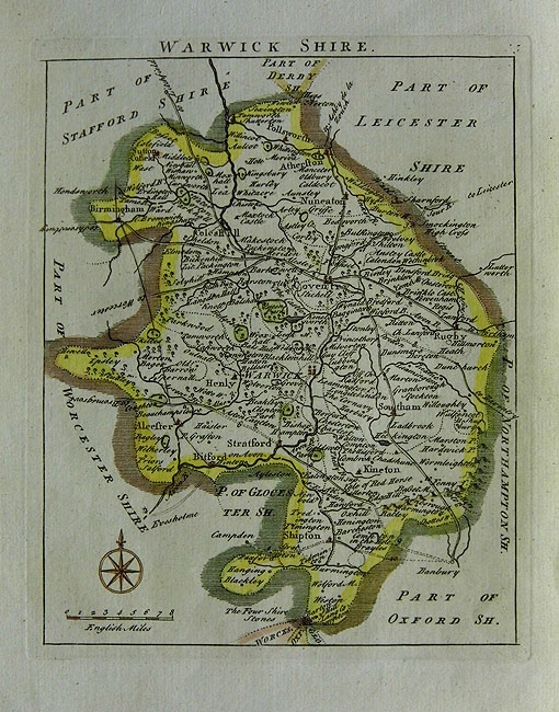
| Artist | Rocque, John |
| Published | c.1769 |
| Dimensions | 192 x 157 mm |
| Notes |
A fine eighteenth century maps of Warwickshire, with compass rose and scale of miles in bottom left corner. John [Jean] Rocque (c.1704 - 1762) was a Huguenot emigré surveyor who worked in London from about 1734. His early work was concentrated on large scale plans of the estates and gardens of the Crown and aristocracy. As his reputation grew, his projects became more ambitious; he embarked on large-scale surveys of English towns and individual counties. Perhaps his best known works are his survey of the Cities of London and Westminster. Rocque also prepared large numbers of maps of countries and parts of the world, often issued separately, which accounts for their scarcity. In 1746 he produced a set of pocket-sized county maps for The English Traveller. |
| Framing | mounted |
| Price | £120.00 |
| Stock ID | 31123 |