
| Method | Chromolithograph |
| Artist | Stanford, Edward |
| Published | London: Edward Stanford 12, 13 & 14, Long Acre, W.C. [1901] |
| Dimensions | 350 x 530 mm |
| Notes |
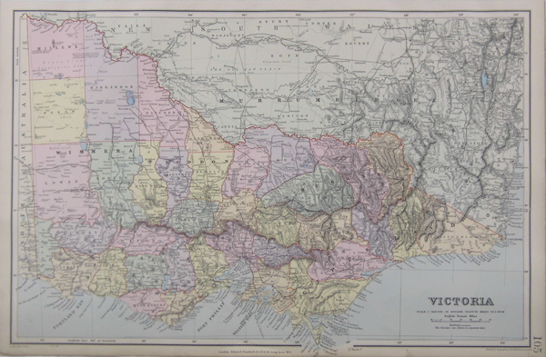
A large map of the Australian State of Victoria, with the southern half of New South Wales and the Murray River border, and the extreme eastern border of South Australia. Counties are outlined in red and tinted in different pastel colours, with railways marked. This is map 105 from Stanford's London Atlas Series, published by Stanford's Geographical Establishment. Edward Stanford (1827-1904) was a British publisher and cartographer, and founder of Stanford's Ltd. In the mid 1850's, Stanford founded his business in response to rapid British colonial expansion and the demand for accurate, high-quality, and accessible maps that resulted. As well as producing his own maps, Stanford also reprinted a number of other series, including the popular maps of principle cities by the Society for the Diffusion of Useful Knowledge. Stanford's son, also named Edward, succeeded his father in 1884. Condition: Small tear in lower right margin not affecting image or inscription. |
| Framing | unmounted |
| Price | £80.00 |
| Stock ID | 35991 |