
| Method | Copper engraved with hand colour |
| Artist | Ortelius, Abraham |
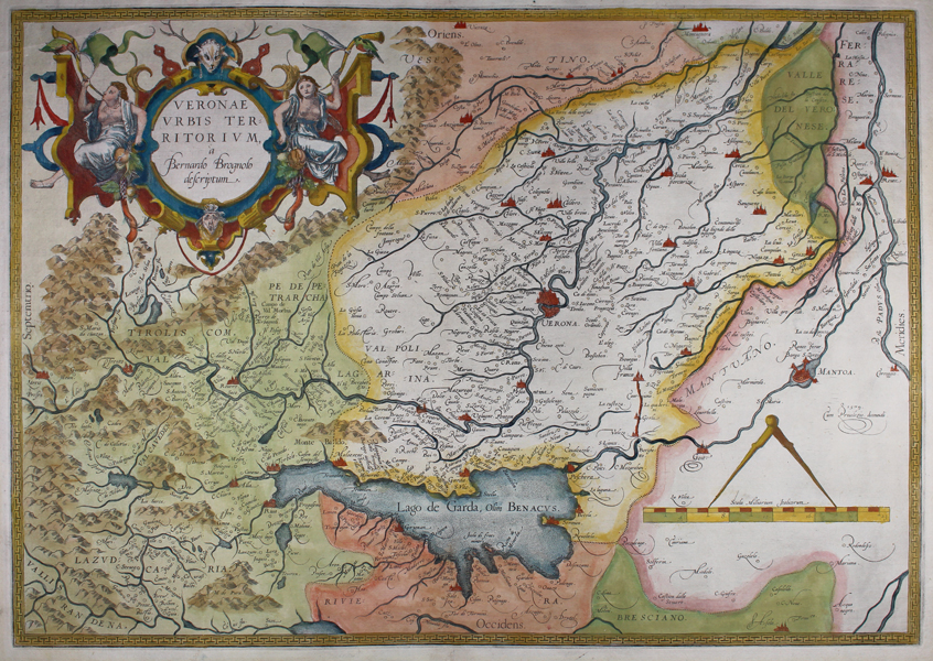
| Published | a Bernardo Brognolo descriptum. Cum Privilegio decennali 1579 [Antwerp, 1579] |
| Dimensions | 330 x 465 mm |
| Notes |
A first state printing of Ortelius' map of the territory around Verona, in the Veneto, Italy, from the 1579 Latin edition of the famous Theatrum Orbis Terrarum. The map is oriented with east to top. The borders of the region, as well as neighbouring regions, are outlined or washed in hand colour, principal cities and towns are picked out in red, and mountains, lakes, and rivers are shown pictorially. In the top left corner, a large decorative title cartouche is flanked by a pair of bare-chested maidens blowing horns and carrying symbols of agricultural abundance. The title attributes the map's cartography to Bernardo Brognoli, whose map of the region was published by Forlani in 1574. Abraham Ortelius (1527 -1598) was a Flemish cartographer, cosmographer, geographer and publisher and a contemporary of Gerard Mercator, with whom he travelled through Italy and France. Although it is Mercator who first used the word "Atlas" as a name for a collection of maps, it is Ortelius who is remembered as the creator of the first modern atlas. Theatrum Orbis Terrarum was the first systematically collated set of maps by different map makers in a uniform format. Three Latin editions as well as a Dutch, French and German edition of Theatrum Orbis Terrarum were published by 1572 and a further 25 editions printed before Ortelius' death in 1598. Several more were subsequently printed until around 1612. Ortelius is said to have been the first person to pose the question of the continents once being a single land mass before separating into their current positions. Condition: Central vertical fold as issued. Repaired tear to bottom of central margin. Latin text on verso. |
| Framing | unmounted |
| Price | £500.00 |
| Stock ID | 48464 |