
| Method | Lithograph with original hand colour |
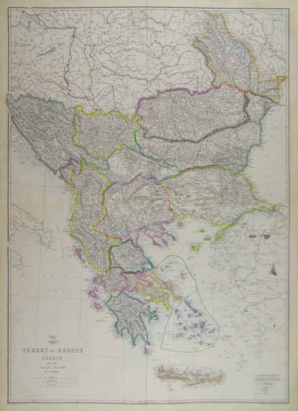
| Artist | Ettling, T. |
| Published | London: Published at the "Weekly Dispatch" Office, 139, Fleet Street, London, and Sold by All Booksellers and Newsagents. 1863. |
| Dimensions | 855 x 600 mm |
| Notes |
From The Dispatch Atlas. Originally printed and bound as four separate sheets, the sheets are now glued together to make one large-scale map. Between 1857 and 1863, the British newspaper The Weekly Dispatch published a series of maps. Over 100 maps were produced, and in 1863, the maps were gathered together to form The Dispatch Atlas. The atlas contained county and country maps, as well as several city maps. Each of the maps featured a distinctive image of a half-globe with a winged mercury above. Condition: Central horizontal and vertical joins. Some time toning and creasing to sheet, and ink stain to lower right section of map. |
| Framing | unmounted |
| Price | £60.00 |
| Stock ID | 38858 |