
| Method | Copper engraved with early hand colour |
| Artist | Porro, Girolamo after Magini, Giovanni Antonio |
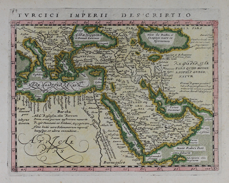
| Published | [Petrus Keschedt, Cologne, 1597] |
| Dimensions | 127 x 174 mm |
| Notes |
A map of the Turkish Empire, centring on the Arabian Peninsula, from the 1597 Latin printing of Giovanni Antonio Magini's edition of Claudius Ptolemy's Geographia. The map, ornamented in early colour, charts the extent of the empire from Northern Africa and the eastern end of the Mediterranean across Turkey, the Holy Land, and Arabia. Interestingly the Caspian Sea has been strangely charted, replicating the map produced by Ortelius of the same region. Girolamo Porro (c. 1520-1604) was an Italian engraver active in Venice and his native Padua, working predominantly as a map engraver for Tommaso Porcacchi, and Girolamo Ruscelli. Giovanni Antonio Magini (1555-1615) was an Italian scientist, cartographer, and chair of mathematics at the University of Bologna. A prominent geocentrist, he was a correspondent of many notable contemporaries, including Tycho Brahe, Kepler, and Ortelius. His commentary on Ptolemy's Geographia, with accompanying copper-plate maps by Porro, appeared in Latin in its first edition in 1596, with the first Italian translation by Leonardo Cernoti printed in 1598. Condition: Time toning to sheet. Latin text on verso. |
| Framing | unmounted |
| Price | £300.00 |
| Stock ID | 47356 |