
| Method | Lithograph with hand colour |
| Artist | [Anonymous] |
| Published | [c.1880] |
| Dimensions | 400 x 300 mm |
| Notes |
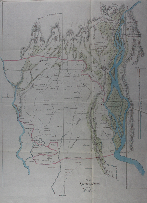
An unusual British Raj-era map of the territory north of the town of Bareilly, in the Indian state of Uttar Pradesh. The map shows a popular circuit of shooting places, marked in red on a dashed line. The map was likely included in a guide to the region, or perhaps a sporting magazine or periodical. Condition: Vertical and horizontal folds, as issued. Right corner of top margin trimmed to border, as issued. |
| Framing | unmounted |
| Price | £100.00 |
| Stock ID | 47351 |