
| Method | Steel engraved with hand colour |
| Artist | Wyld, James |
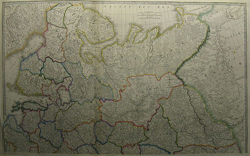
| Published | Published by James Wyld, London, c.1843. |
| Dimensions | 541 x 923 mm |
| Notes |
James Wyld's map was a revised and corrected edition of Jaspar Nantiat's Russian Atlas of 1806. The revisions include the addition of postal roads as well as the demarcations of the new governments. It was printed in two sheets; this map forming the top half of the completed work. Regardless of this, the remarkable detail and size of the halves make them quite suitable for individual display. Condition: Two vertical folds as issued. |
| Framing | unmounted |
| Price | £220.00 |
| Stock ID | 27837 |