
| Method | |
| Artist | [Anonymous] |
| Published | Oxford University Press 1964 |
| Dimensions | 930 x 640 mm |
| Notes |
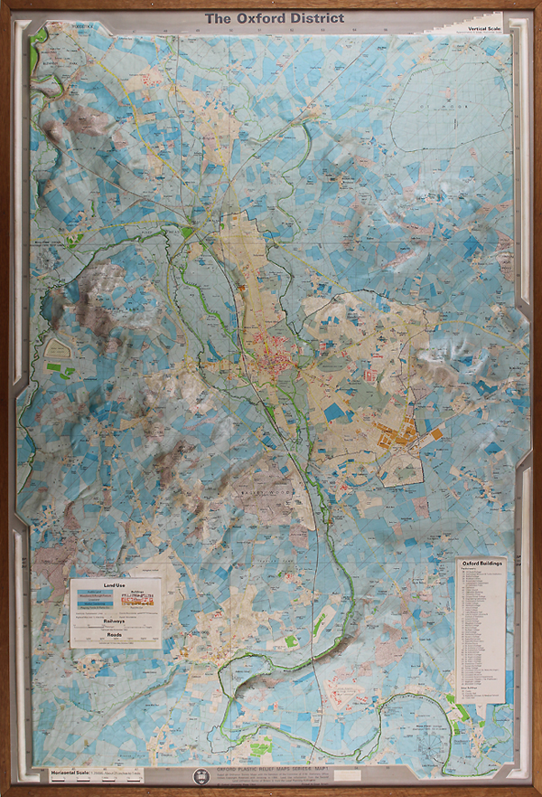
Oxford Plastic Relief Maps Series 6 Map 1. Based on Ordnance Survey Maps with the Sanction of the Controller of H.M. Stationery Office Crown Copyright Reserved, with revisions to 1964. Land Use information from the Second Land Utilisation Survey of Britain & from Local Planning Authorities. The Cartographic Department of the Clarendon Press issued a series of plastic relief models. This model is printed in full colour and is a relief version of the Ordnance Survey's 2 1/2 inches to the mile map. It covers an area of roughly 16 miles from north to south and 11 miles east to west, with the city of Oxford in the centre of the map. Woodstock is just included in the extreme north-west and Dorchester is in the south-east corner. The map has a number of novel features. The vertical scale in the model is represented at six times to horizontal scale. There are 11 different colours used in the map to indicate land use. Water, including streams and rivers, are indicated in green, while roads are marked in yellow. Arable land, grassland and market gardens are differentiated in different shades of blue. Four colours are used for different types of buildings: purple for shops, orange for commercial and industrial, red for public buildings and yellow for residential. Woodland and rough pasture are shown in a shade of mauve, while playing fields are indicated by a grey tone. Oxford appears to be in a sea of blue. "The model could be criticised on the grounds that too much information has been included, but this is unfair, it should be regarded as a mine from which a great variety of material can be extracted." Refrence: Gilbert, E.W. "Oxford: Venice of the North," The Geographical Journal, Vol. 131, No. 4, 1965, p. 350-352. Condition: Good cleanprinted surface, framed and glazed in it's original plain oak frame. |
| Framing | framed |
| Price | £450.00 |
| Stock ID | 50080 |