
| Method | Chromolithograph |
| Artist | Clevely, Alfred J. |
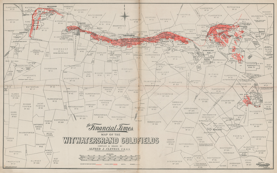
| Published | Compiled & Drawn by Alfred J. Clevely, F.R.G.S. Published by The Financial Times. 72, Coleman Street, London, E.C.2. Compiler's Copyright [c.1928] |
| Dimensions | 520 x 850 mm |
| Notes |
A large folding map of the mines and land titles of the Witwatersrand Goldfields, with Johannesburg at centre, published by the Financial Times. The map is undated, and draws heavily upon earlier surveys, particularly the map produced by Sydney Goldmann prior to the infamous Jameson Raid and the outbreak of the Second Boer War, but was likely issued around the time Johannesburg was formally declared a city in 1928. The map's focus is solely directed towards the mines, with the outcrop of the main gold reef marked in a solid line across the map from west of Krugersdorp to Springs, with tentative extensions in Rietfontein and Klipfontein marked as a dashed line. Stoped land is marked in hatched red, and mine shafts are simple black dots. Aside from the railways and the Rand Water Board, very few public amenities are featured. Alfred J. Clevely (fl.1920s) was a British surveyor and geographer, who was made a Fellow of the Royal Geographical Society in 1919. Condition: Vertical and horizontal folds, as issued. Time toning to edges of sheet, and to folds. Foxing to central vertical fold. Some splitting and small holes to folds. Blank on verso. |
| Framing | unmounted |
| Price | £250.00 |
| Stock ID | 51930 |