
| Method | Chromolithograph |
| Artist | Stanford, Edward |
| Published | London: Edward Stanford 12, 13 & 14, Long Acre, W.C. [1901] |
| Dimensions | 470 x 620 mm |
| Notes |
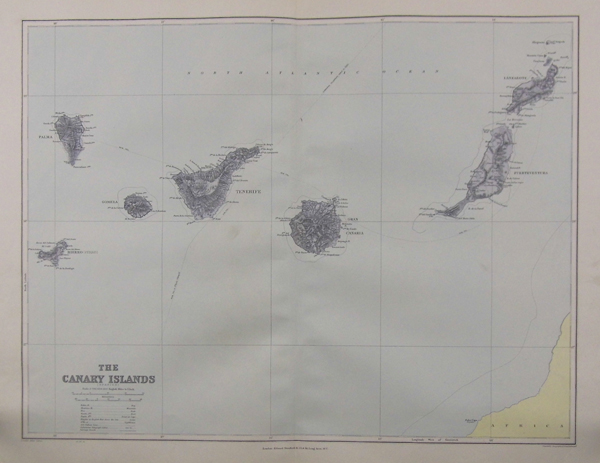
A large map of the Canary Islands: Hierro (Ferro), Palma, Gomera, Tenerife, Gran Canaria, Fuerteventura, and Lanzarote. The coast of Africa is visible in the bottom right, and submarine telegraph lines are clearly marked. From Stanford's London Atlas Series, published by Stanford's Geographical Establishment. Edward Stanford (1827-1904) was a British publisher and cartographer, and founder of Stanford's Ltd. In the mid 1850's, Stanford founded his business in response to rapid British colonial expansion and the demand for accurate, high-quality, and accessible maps that resulted. As well as producing his own maps, Stanford also reprinted a number of other series, including the popular maps of principle cities by the Society for the Diffusion of Useful Knowledge. Stanford's son, also named Edward, succeeded his father in 1884. Condition: Central vertical fold as issued. Small tears to bottom right, not affecting image. |
| Framing | unmounted |
| Price | £90.00 |
| Stock ID | 35995 |