
| Method | Copper engraved |
| Artist | Merian, Matthäus |
| Published | [Frankfurt, c.1641] |
| Dimensions | 260 x 355 mm |
| Notes |
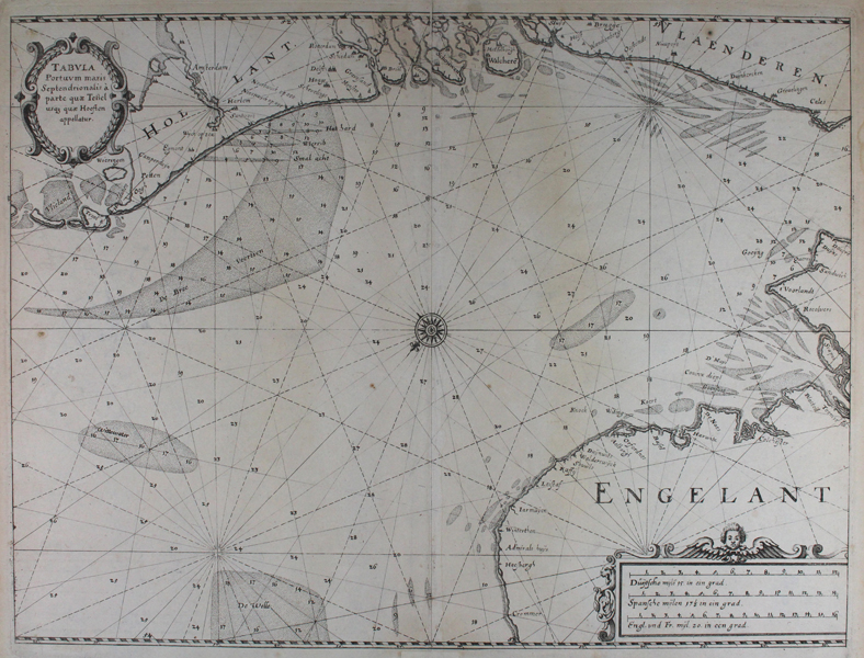
An unusual sea chart of the English Channel, with east to top, from Merian's Theatrum Europaeum. The map shows the south eastern coast of England, from Dover in Kent to Cromer in Norfolk in the bottom right corner, while the coasts of Flanders and Holland on the other side of the channel run along the top of the map. English towns and cities are named in Dutch, while the Dutch and Flemish cities of Amsterdam, Haarlem, The Hague, Delft, Rotterdam, and Bruges are shown pictorially. Sandbars and shoals are marked as dotted patches, depth soundings are marked, and the map is criss-crossed with numerous rhumb lines. At centre, a small but ornate compass rose points north. The map is further embellished by a pair of decorative cartouches, one enclosing the title, and another containing a set of scales in Dutch, Spanish, and English miles. Matthäus Merian the Elder (22 September 1593 - 19 June 1650) was a Swiss engraver born in Basel. Beginning his career in Zürich where he learned the art of copperplate engraving, Merian went on to study and work in various cities throughout France. In 1615, Merian returned to Basel. His return to Basel, however, was short lived, moving to Frankfurt the following year to work for the publisher Johann Theodor de Bry. Merian later married de Bry's daughter. He was also the father of Maria Sibylla Merian, one of the greatest natural history artists of the late 17th and early 18th centuries. Condition: Central vertical fold as issued. Minor time toning to sheet. Repaired tear and strengthening to top and bottom of centre fold. |
| Framing | unmounted |
| Price | £450.00 |
| Stock ID | 46908 |