
| Method | Copper engraved with early hand colour |
| Artist | Euler, Leonhard |
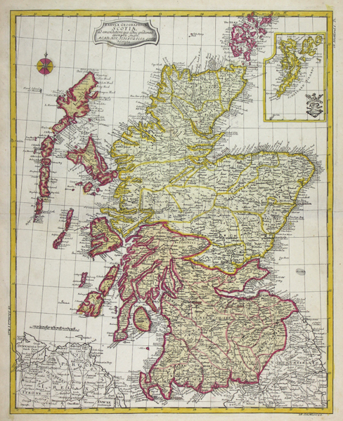
| Published | Acad. Reg. Scient. et Eleg. Litt. descripta. [Berlin, c.1753] |
| Dimensions | 385 x 306 mm |
| Notes |
An uncommon mid-eighteenth century map of Scotland, from Leonhard Euler's Atlas geographicus omnes orbis terrarum regiones, a school atlas published by the Prussian Royal Academy of Sciences. Despite being a German map, placenames and topographical features are given in English, and the title is in Latin, with the only inconsistency being the use of 'Schetland' for the inset map of the Shetland Islands. The map is ornamented in fine early outline hand colour. Leonhard Euler (1707-1783) was a Swiss cartographer, physician, and mathematician, best known for his many pioneering discoveries in the mathematical fields of analytic number theory, complex analysis, and infinitesimal calculus. His discoveries have earned him a reputation as being among the finest and most influential mathematical minds in history. Much of his life was spent in St Petersburg, in the employ of Frederick II and subsequently Catherine the Great. Condition: Central horizontal fold, as issued. Prussian tax seal to top right of sheet, as issued. Time toning to margins. Manuscript 'No. 16' to verso, otherwise blank. |
| Framing | unmounted |
| Price | £325.00 |
| Stock ID | 50415 |