
| Method | Copper engraving |
| Artist | Porro, Girolamo after Magini, Giovanni Antonio |
| Published | [Petrus Keschedt. Cologne, 1597] |
| Dimensions | 128 x 170 mm |
| Notes |
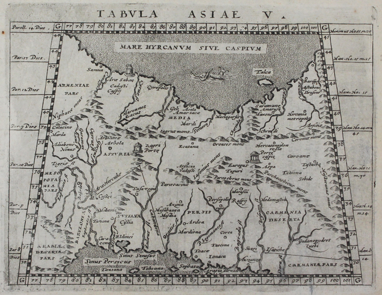
A trapezoidal miniature map of Persia and Central Asia, modern day Iran, Iraq, and parts of Armenia and Azerbaijan, from the 1597 Latin printing of Giovanni Antonio Magini's edition of Claudius Ptolemy's Geographia. The map is centred on the region between the Caspian Sea and the Persian Gulf. In the Caspian Sea, here also labelled using the Ptolemaic title of Hyrcanian Sea, is Porro's favourite sea-monster, a giant elephant-headed fish. A number of small shrines are also marked, illustrating altars and gates, some of which were supposedly raised by Alexander the Great during his expedition to India. Girolamo Porro (c. 1520-1604) was an Italian engraver active in Venice and his native Padua, working predominantly as a map engraver for Tommaso Porcacchi, and Girolamo Ruscelli. Giovanni Antonio Magini (1555-1615) was an Italian scientist, cartographer, and chair of mathematics at the University of Bologna. A prominent geocentrist, he was a correspondent of many notable contemporaries, including Tycho Brahe, Kepler, and Ortelius. His commentary on Ptolemy's Geographia, with accompanying copper-plate maps by Porro, appeared in Latin in its first edition in 1596, with the first Italian translation by Leonardo Cernoti printed in 1598. Condition: Minor time-toning to edges of sheet. Trimmed to plate mark along bottom margin, not affecting map. Latin text on verso. |
| Framing | unmounted |
| Price | £200.00 |
| Stock ID | 45488 |