
| Method | Copper engraving |
| Artist | Porro, Girolamo after Magini, Giovanni Antonio |
| Published | [Petrus Keschedt. Cologne, 1597] |
| Dimensions | 130 x 170 mm |
| Notes |
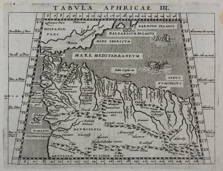
A trapezoidal miniature map of western North Africa, modern day Morocco, and Algeria, as well as the southern parts of Spain and the Balearic Islands, from the 1597 Latin printing of Giovanni Antonio Magini's edition of Claudius Ptolemy's Geographia. The map shows the ancient Ptolemaic regions of Mauritania, Tingitania, and Africa Caesariensis. In the waters of the Mediterranean, two sea monsters roam, including one with a leonine head. Girolamo Porro (c. 1520-1604) was an Italian engraver active in Venice and his native Padua, working predominantly as a map engraver for Tommaso Porcacchi, and Girolamo Ruscelli. Giovanni Antonio Magini (1555-1615) was an Italian scientist, cartographer, and chair of mathematics at the University of Bologna. A prominent geocentrist, he was a correspondent of many notable contemporaries, including Tycho Brahe, Kepler, and Ortelius. His commentary on Ptolemy's Geographia, with accompanying copper-plate maps by Porro, appeared in Latin in its first edition in 1596, with the first Italian translation by Leonardo Cernoti printed in 1598. Condition: Minor time-toning to edges of sheet. Small water stain to right edge of sheet, not affecting map. Latin text on verso. |
| Framing | unmounted |
| Price | £120.00 |
| Stock ID | 45489 |