
| Method | Copper engraved with hand colour |
| Artist | de Lat, Jan |
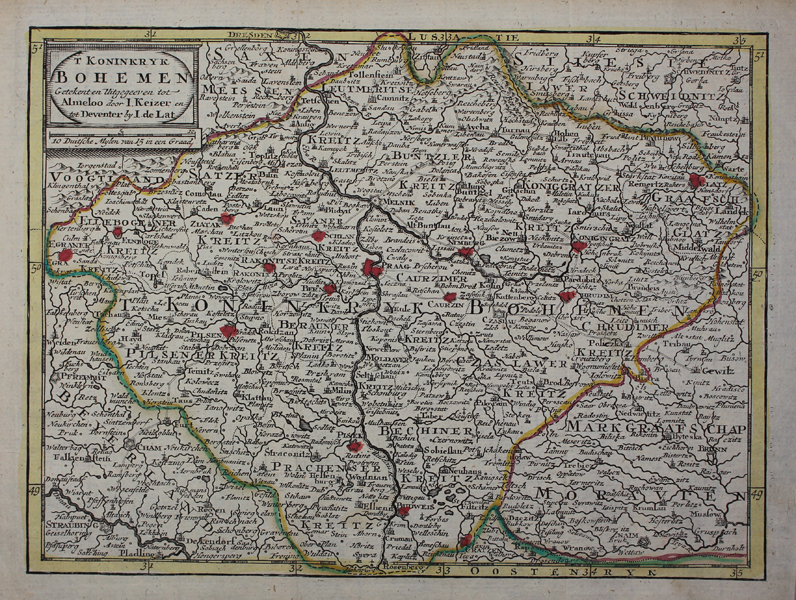
| Published | Getekent en Uitgegeeven tot Almeloo door I. Keizer en tot Deventer by I. de Lat [Amsterdam, c.1788] |
| Dimensions | 170 x 230 mm |
| Notes |
A rare late-eighteenth century Dutch map of Bohemia, roughtly the modern day Czech Republic, engraved by de Lat and reissued in Gerrit Brender a Brandis' Nieuwe Natuur-Geschied-en Handelkundige Zak-en Reis-Atlas. Regional boundaries are outlined in hand colour and cities are picked out in red, with Prague conspicuous at centre. Jan de Lat (fl.1735-1750) was a Dutch printmaker, cartographer, and publisher, active predominantly in Deventer. Little is known of his life, and his publishing house was much more modest when compared to other cartographic contemporaries, including van der Aa, de Wit, and Carel Allard, though in conjunction with Jakob Keyzer of Almelo he produced an Atlas Portatif. Like de Leth, a number of de Lat's plates were reissued by Brender a Brandis. Condition: Vertical folds as issued. Minor time toning to edges of sheet. Blank on verso. |
| Framing | unmounted |
| Price | £75.00 |
| Stock ID | 48929 |