
| Method | Steel engraved with hand colour |
| Artist | Rapkin, John |
| Published | The London Printing and Publishing Compan, 1851. |
| Dimensions | 235 x 310 mm |
| Notes |
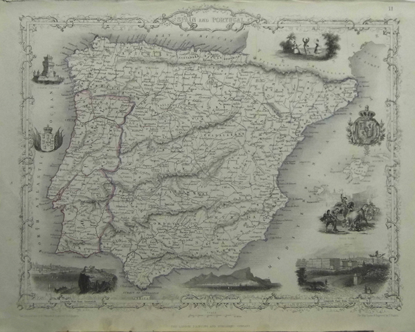
From The Illustrated Atlas, And Modern History Of The World Geographical, Political, Commercial & Statistical. Beginning in 1851, John Tallis & Co. issued their Illustrated Atlas, which contained maps of all parts of the world. These are among the most popular nineteenth century maps available to the collector. The maps are very detailed, with copious topographical and political information presented with excellent clarity. However, it is for their decorative borders and the small, finely engraved vignettes of local scenes that these maps are particularly known and enjoyed. |
| Framing | unmounted |
| Price | £100.00 |
| Stock ID | 31682 |