
| Method | Copper engraved with hand colour |
| Artist | Cluver, Philipp and Senex, John |
| Published | [London, c.1712] |
| Dimensions | 135 x 210 mm |
| Notes |
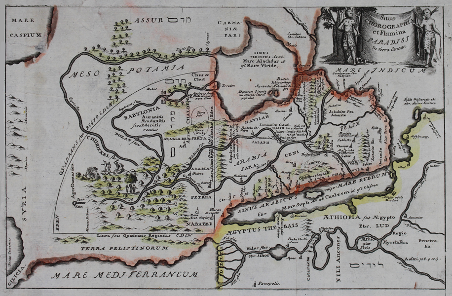
An unusual map of the Holy Land and Egypt, purporting to show the location of the Garden of Eden, from an early eighteenth century printing of Philipp Cluver's Introductio in Universam Geographicam. The London editions of the this atlas featured reengraved maps by John Senex and Herman Moll. The map itself is oriented with East to top. A large quadrant, representing the territory of Eden, covers a large area across modern day Syria, Jordan, and Iraq. Vignettes show the fatal apple tree, and Banishment from the Garden. In the top right corner of the map, the title is flanked by representations of Adam and Eve. Philipp Cluver (1580-1622) was born in Danzig and after studying at Leyden and Oxford, he became interested in modern and historical geography. His subsequent publications made a wide and influential contribution to knowledge of the subject. Philip Cluver's "Introductonius" was a popular geography book, first published in 1624 without maps. There were many editions throughout the 17th and 18th centuries with maps from several sets of plates. John Senex (fl.1690-1740) was a British engraver, publisher, surveyor, and geographer to Queen Anne. Working with James Maxwell and Charles Price early in the 18th century, he produced some admirable maps of the world and continents including loose maps of many countries. In 1719 he issued a miniature, updated edition of Ogilby's 'Britannia'. This publication went through many editions and was inspired by the great interest he seemed to show in road maps. Condition: Vertical folds as issued. Trimmed within plate on left margin, without loss to map. Small chips and creases to margins. Repaired puncture to top left corner of map. |
| Framing | unmounted |
| Price | £100.00 |
| Stock ID | 48356 |