
| Method | Steel engraved with hand colour |
| Artist | Rapkin, John |
| Published | The London Printing and Publishing Company, [c. 1855] |
| Dimensions | 250 x 330 mm |
| Notes |
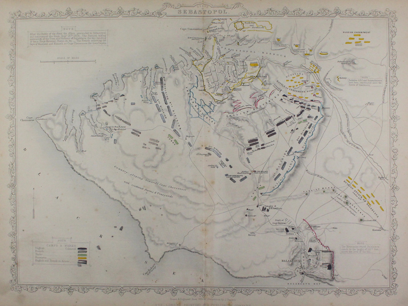
A map illustrating the Siege of Sebastopol or Sevastopol of the 26th of September 1854, featuring a hand coloured key to the different armed forces. From Henry Tyrrell's The History of the War with Russia c. 1855. John Rapkin (1815-1876) was an engraver and mapmaker active in Britain in the mid-nineteenth century. He drew and engraved the maps for John Tallis' The Illustrated Atlas and Modern History of the World (1845-51), which was later re-issued by the London Printing and Publishing Company. He also drew and engraved maps for R. Montgomery Martin's British Colonies, their history (1849), and Wright's Universal Pronouncing Dictionary (c.1850). Condition: Vertical centrefold as issued. Overall time toning and light dirt build up to sheet. Hand colouring offsetting to left hand side of map. |
| Framing | unmounted |
| Price | £80.00 |
| Stock ID | 43380 |