
| Method | Copper engraved with hand colour |
| Artist | Cluver, Philipp |
| Published | [London, c.1712] |
| Dimensions | 260 x 315 mm |
| Notes |
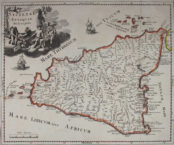
A map of Sicily, from an early eighteenth century printing of Philipp Cluver's Introductio in Universam Geographicam. The map shows Sicily according to classical geography, with ancient Greek, Carthaginian, and Roman place names. The defensive walls of Syracuse are shown pictorially, as is Mt Etna, with smoke billowing from its peak. A pair of sailing ships ply the waters of the Tyrrhenian Sea, and in the top left, a large title cartouche is supported by figures representing the islands wealth and abundance. Philipp Cluver (1580-1622) was born in Danzig and after studying at Leyden and Oxford, he became interested in modern and historical geography. His subsequent publications made a wide and influential contribution to knowledge of the subject. Philip Cluver's "Introductonius" was a popular geography book, first published in 1624 without maps. There were many editions throughout the 17th and 18th centuries with maps from several sets of plates. Condition: Vertical and horizontal folds as issued. Trimmed to border along right, bottom, and bottom left margins, as issued. Creasing, foxing, and small tear to left of horizontal fold. Blank on verso. |
| Framing | unmounted |
| Price | £230.00 |
| Stock ID | 48840 |