
| Method | Steel engraved with original hand colour |
| Artist | Cary, John |
| Published | London: Published by G & J.Cary, 86 St. James's Street June 3rd. 1823. |
| Dimensions | 495 x 630 mm |
| Notes |
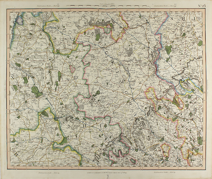
Sheet 26 from George and John Cary's incredibly detailed 'Improved map of England' covering the northern and eastern parts of Oxfordshire, Buckinghamshire, and the bordering counties of Berkshire, Northamptonshire and Bedfordshire. Counties are outlined in fine original hand colour, private estates are picked out in green, and the road network is also coloured. A scale of half an inch to a mile, in 'English Miles' to top margin, alongside notes to the continuation of the map on all sides. John Cary (1755-1835) was an English cartographer, engraver, globe maker and publisher, often working with his brothers George and Francis. In 1770, he was apprenticed to William Palmer, and became surveyor of roads to the general post office around 1794. He is best known for his English county atlases, particularly Cary's New and Correct English Atlas, published in 1787-1789, and the miniature Traveller's Companion. He also engraved the plates for Robert Gough's edition of Camden's Britannia, which was published in 1806. Condition: Pressed centre fold as issued, small tears to top and bottom of centre fold, not affecting printed area. Minor spotting to edges of sheet. |
| Framing | unmounted |
| Price | £400.00 |
| Stock ID | 48703 |