
| Method | Chromolithograph |
| Artist | Philip, George & Son |
| Published | George Philip & Son, Ltd. 32 Fleet Street, London, E.C.4. The London Geographical Institute [c.1910] |
| Dimensions | 770 x 930 mm |
| Notes |
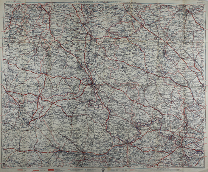
A very large folding map of Oxfordshire and surrounds, Sheet 14 of 'The Royal Automobile Club Official Motoring Map of England & Wales.' The main roadways are marked in red, rivers and canals in blue, and county boundaries in pink. 'Recommended Tourist Centres' are shown with blue stars, and the map also includes notifications of dangerous roads and difficult terrain. The railways are marked as solid black lines, and stations are marked. George Philip (1800–1882) was a cartographer and map publisher. Son of a staunchly Calvinist family, he became in 1819 assistant to the Liverpool bookseller, William Grapel and in 1834 started his own business in Liverpool producing maps and educational books. The business expanded rapidly. He used cartographers (such as John Bartholomew the elder, August Petermann, and William Hughes) to produce maps on copper plates. Philip then had these printed and hand-coloured by his women tinters. By the time he produced his county maps of 1862 he was using machine coloured maps produced on power-driven lithographic presses. He had one son, also George (1823–1902), who was admitted to the business in 1848 (and was the cause of the name change to George Philip & Son Ltd). The company continued to operate successfully until 1987 when it was sold to Reed International. Here it continued to trade as George Philip Ltd. In 1998, following a management buy-out of the Illustrated books division, Philip's became part of the Octopus Publishing Group. Hachette Livre acquired the group in 2001. Condition: Linen backed, with original card wrapper. Horizontal and vertical folds as issued. Minor creasing, wear, and time toning to folds and edges of sheet. |
| Framing | unmounted |
| Price | £60.00 |
| Stock ID | 49656 |