
| Method | Copper engraved |
| Artist | Taylor, Isaac |
| Published | [London, 1751] |
| Dimensions | 265 x 270 mm |
| Notes |
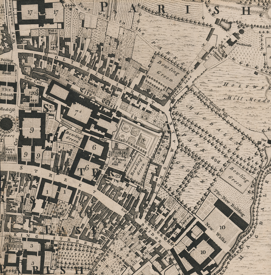
The central section of Isaac Taylor's Plan of Oxford, one of the rarest maps of Oxford. This section, covering the eastern half of the city, stretches from Radcliffe Square to Magdalen College and the Cherwell, and from Wadham in the north to Merton in the south. The footprints of Colleges are marked in black, domestic and commercial buildings in grey. Churches are shown as vignettes, as is the Holywell Music Room, and gardens and meadows are shown pictorially. An interesting convention, and one which would later be used by the Ordnance Survey to great effect, is the use of different typefaces for elements of differing historical eras, so that ruins and vestiges of the Medieval city are labelled in a heavy blackletter, in this case the path of the City Wall. The full map was surveyed by Isaac Taylor and engraved by George Anderton, and first published in 1751 by William Jackson. It is notable for being the first true ichnographic map of the famous university city based on a trigonometric survey and the largest scale map of Oxford made since the 1578 plan by Ralph Agas. It was republished by Faden in 1789. George Anderton (fl.1740–1763) was a British engraver, typefounder, and printer known largely for his work with Isaac Taylor on his 1750 plan of Oxford but also his map of Wolverhampton. Isaac Taylor (fl. 1750 –1778), of Ross-on-Wye in Herefordshire, was a surveyor, draughtsman, and engraver best known for his large-scale surveys of English counties. He is often confused with Isaac Taylor (1730-1807) who also worked with Thomas Jefferys. Condition: Section of much larger map, trimmed with losses on all sides. Central horizontal crease. Blank on verso. |
| Framing | unmounted |
| Price | £150.00 |
| Stock ID | 52678 |