
| Method | Lithograph with original hand colour |
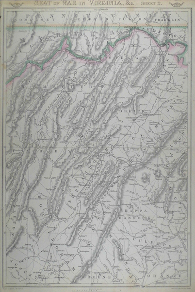
| Artist | Weller, Edward |
| Published | London: Published at the "Weekly Dispatch" Office, 139, Fleet Street, London, and Sold by All Booksellers and Newsagents. 1863. |
| Dimensions | 430 x 310 mm |
| Notes |
From The Dispatch Atlas. A British map of Virginia and Maryland boarders from the Weekly Dispatch Atlas produced in response to the British demand for information about the American Civil War. Between 1857 and 1863, the British newspaper The Weekly Dispatch published a series of maps. Over 100 maps were produced, and in 1863, the maps were gathered together to form The Dispatch Atlas. The atlas contained county and country maps, as well as several city maps. Each of the maps featured a distinctive image of a half-globe with a winged mercury above. Condition: Light creasing to sheet, and a few spots of discolouration. Tear to left of sheet, effecting printed area. |
| Framing | unmounted |
| Price | £90.00 |
| Stock ID | 38569 |