
| Method | Copper engraved |
| Artist | Seller, John and Grose, Francis |
| Published | c. 1787 |
| Dimensions | 107 x 137 mm |
| Notes |
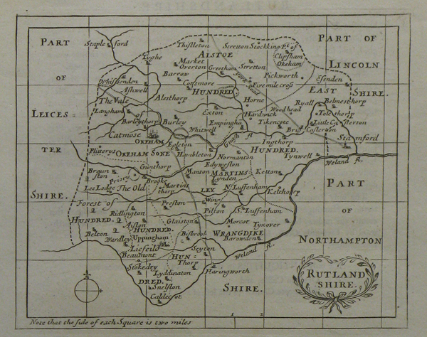
A small scale county map of Rutland, with a decorative title cartouche and mile scale to bottom left. The plates for this series were originally printed for Seller's Anglia Contracta, c. 1697. Francis Grose (1730-1791) later acquired the plates, had them slightly reworked, and reprinted them, as here, in his Antiquities of England and Wales, published between 1773 and 1787. John Seller (1632-1697), hydrographer to Charles II, James II and William II, cartographer and instrument maker, published an attractive series of county maps Anglis Contracta in 1694. The maps were re-printed in The History of England and Camden's Britannia Abridg'd. Over 80 years later the plates were used for Francis Grose's The Antiquities of England and Wales. Condition: Descriptive text below plate and on verso. |
| Framing | mounted |
| Price | £35.00 |
| Stock ID | 22482 |