
| Method | Copper engraved with original hand colour |
| Artist | Robert de Vaugondy, Gilles |
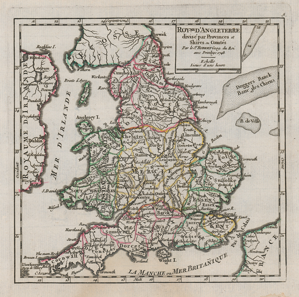
| Published | Paris, 1748 |
| Dimensions | 158 x 162 mm |
| Notes |
A mid eighteenth century map of England and Wales with the county divisions from Vaugondy's Atlas Portatif Universel. Gilles Robert de Vaugondy (1688-1766) and his son Didier (1723-1786) were French cartographers, publishers, and globe-makers, responsible for the publication of the Atlas Universel (1757), one of the most significant cartographical achievements of the 18th century. The de Vaugondy family were descendants of the cartographer Nicholas Sanson d'Abbeville, and inherited many of his plates. These were reissued with updated astronomical observations and corrected longitudinal and latitudinal information in the Atlas Universel. Didier continued reissuing the Atlas after his father's death, and was appointed geographer to Louis XV later in life. Gilles often signed his maps simply as Sr. (or Sieur) Robert, whilst Didier usually used 'Robert de Vaugondy' as his signature, occassionally adding 'fils' to clearly distinguish himself from his father. Condition: Some staining to the left of the left margin not affecting the printed area. |
| Framing | mounted |
| Price | £100.00 |
| Stock ID | 52550 |