
| Method | Copper engraved with hand colour |
| Artist | Robert de Vaugondy, Gilles |
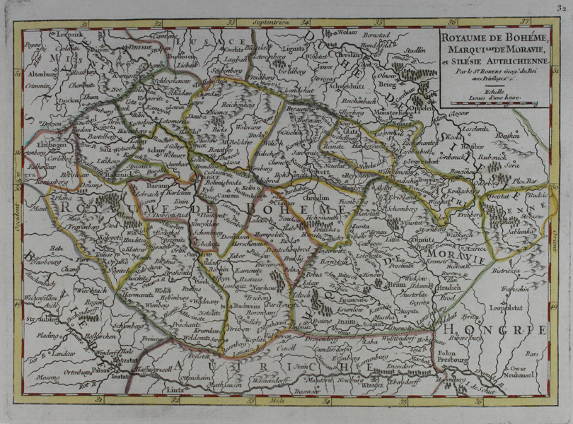
| Published | Par le Sr. Robert Geog. du Roi avec Privilege. [Paris, c.1748] |
| Dimensions | 160 x 230 mm |
| Notes |
A French map of Bohemia, Moravia, and Silesia, roughly equable with modern day Czech Republic, Slovakia, and Poland, along with adjoining parts of Hungary, Germany, and Austria, by de Vaugondy. Provincial and national borders are outlined in hand colour, and forests and mountain ranges are shown pictorially. Gilles Robert de Vaugondy (1688-1766) and his son Didier (1723-1786) were French cartographers, publishers, and globe-makers, responsible for the publication of the Atlas Universel (1757), one of the most significant cartographical achievements of the 18th century. The de Vaugondy family were descendants of the cartographer Nicholas Sanson d'Abbeville, and inherited many of his plates. These were reissued with updated astronomical observations and corrected longitudinal and latitudinal information in the Atlas Universel. Didier continued reissuing the Atlas after his father's death, and was appointed geographer to Louis XV later in life. Gilles often signed his maps simply as Sr. (or Sieur) Robert, whilst Didier usually used 'Robert de Vaugondy' as his signature, occassionally adding 'fils' to clearly distinguish himself from his father. Condition: Small paper inclusion to left side of plate, between the 'Y' and 'A' of 'Royaume.' |
| Framing | unmounted |
| Price | £45.00 |
| Stock ID | 45796 |