
| Method | Copper engraved with hand colour |
| Artist | Homann, Johann Baptist |
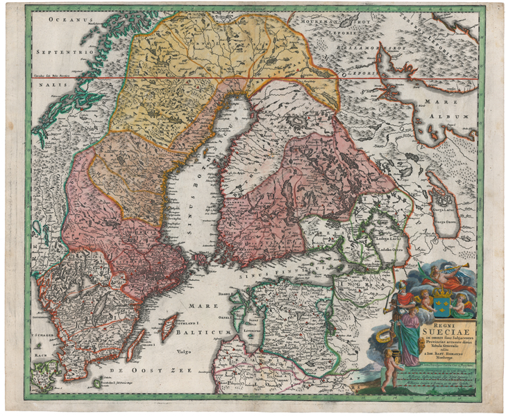
| Published | edita a Ioh. Bapt. Homanno Noribergae. Cum Privilegio Sacrae Caes. Majestatis. [Nuremberg, c.1740] |
| Dimensions | 485 x 560 mm |
| Notes |
A large and impressive mid-eighteenth century map of Sweden, including much of modern-day Finland, published by Homann for the Maior Atlas Superiore. The map is presented in full hand colour, and principal cities are picked out in red. Adjoining parts of Norway, Russia, and the Baltic states are shown in outline colour. In the bottom right corner, the title is surrounded by a large vignette of cherubs and figures of victory, as well as a mile scale. Johann Baptist Homann (20th March 1664 - 1st July 1724) was a German engraver and cartographer, and the Imperial Geographer to the Holy Roman Emperor Charles VI. In 1702 he opened a publishing house in Nuremberg, and his maps often make reference to his membership of the Prussian Royal Academy of Sciences and his imperial patronage. Upon his death, his maps passed to the Homann Heirs company and reprinted many times before the company closed in 1848. Condition: Central vertical fold, as issued. Large vertical creases to left side of sheet. Minor time toning, creasing, and repaired tears to margins. Blank on verso. |
| Framing | unmounted |
| Price | £400.00 |
| Stock ID | 51672 |