
| Method | Copper engraved with hand colour |
| Artist | Homann Heirs |
| Published | Studio Homannianorum Heredum, A°. 1747 |
| Dimensions | 460 x 540 mm |
| Notes |
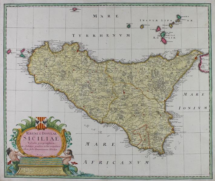
A large and impressive mid-eighteenth century map of Sicily, published by the Homann Heirs for the Maior Atlas Superiore. The map is ornamented in full and beautiful hand colour, in Homann's characteristic pink, green, and yellow pastel palette. Principal cities and towns are picked out in red, the roads are shown, and hills, including the volcanic Mt Etna, are depicted pictorially. In the top right corner of the map, the Aeolian islands are shown, along with the southernmost tip of Calabria across the Straits of Messina. In the bottom left corner, a large baroque cartouche encloses the title and a scale in miles, supported by a pair of Tritons and surmounted by the Arms of the Kingdom of Sicily. Johann Baptist Homann (20th March 1664 - 1st July 1724) was a German engraver and cartographer, and the Imperial Geographer to the Holy Roman Emperor Charles VI. In 1702 he opened a publishing house in Nuremberg, and his maps often make reference to his membership of the Prussian Royal Academy of Sciences and his imperial patronage. Upon his death, his maps passed to the Homann Heirs company and reprinted many times before the company closed in 1848. Condition: Central vertical fold, as issued. Minor time toning to margins. Old pastedown guards to corners of sheet on verso. Blank on verso. |
| Framing | unmounted |
| Price | £600.00 |
| Stock ID | 51065 |