
| Method | Steel engraved |
| Artist | Pigot, James |
| Published | [Published by Pigot & Co. Fleet Street, London, & Fountain St, Manchester, 1840.] |
| Dimensions | 370 x 565 mm |
| Notes |
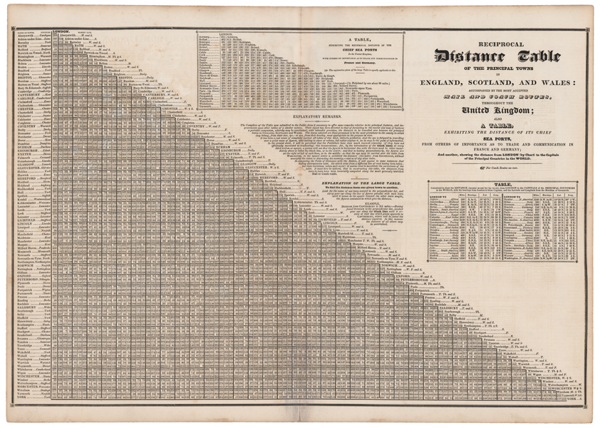
A large nineteenth century reference chart, showing the distances in miles between principal British towns and cities, from Pigot's British Atlas. A large explanatory text describes the use of the table, and two smaller inset charts show the distances between sea ports within the British Isles as well as key ports in France, Germany, and the Netherlands, and the distances between London and various world capitals. On the verso, various road routes within the British Isles and their distances are shown. James Pigot (1769-1843) was an English cartographer, engraver, printer, and publisher. He is best known for his series of finely engraved oblong county maps, issued in various National Commercial Directories throughout the 1820s and 1830s, and published collectively as Pigot & Co's British Atlas in 1831. Pigot traded in London with Charles Elkins and Isaac Slater under the names Pigot & Co and Pigot & Slater, while at the same time trading in Manchester in partnership with his son, James Pigot Jnr, under the name Pigot & Son. Condition: Vertical fold, as issued. Minor time toning to central fold and edges of sheet. |
| Framing | unmounted |
| Price | £75.00 |
| Stock ID | 51566 |