
| Method | Copper engraved with hand colour |
| Artist | Cluver, Philipp |
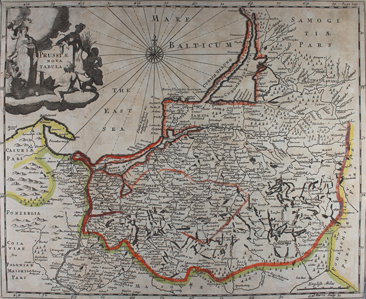
| Published | I. Harris Sculp. [London, c.1712] |
| Dimensions | 260 x 325 mm |
| Notes |
A map of the historic Duchy of Prussia, now part of modern Poland, from an early eighteenth century printing of Philipp Cluver's Introductio in Universam Geographicam. The map covers what is now northern Poland, as well as adjoining parts of Lithuania, Latvia, and Germany. The borders of the various states and kingdoms of the region are outlined in hand colour, and a large title cartouche occupies the top left corner of the map, next to a compass rose in the Baltic Sea. Philipp Cluver (1580-1622) was born in Danzig and after studying at Leyden and Oxford, he became interested in modern and historical geography. His subsequent publications made a wide and influential contribution to knowledge of the subject. Philip Cluver's "Introductonius" was a popular geography book, first published in 1624 without maps. There were many editions throughout the 17th and 18th centuries with maps from several sets of plates. Condition: Vertical and horizontal folds as issued. Time toning and foxing to sheet. Trimmed to margins along left, bottom, and bottom right margins. Tear to right of horizontal fold. Blank on verso. |
| Framing | unmounted |
| Price | £80.00 |
| Stock ID | 48844 |