
| Method | Copper engraved |
| Artist | Arsenius, Ambrose and Ferdinand after Ortelius, Abraham |
| Published | [Jan Baptist Vrients, Antwerp, 1609] |
| Dimensions | 85 x 118 mm |
| Notes |
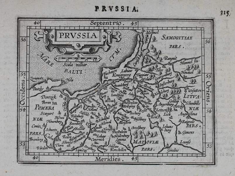
A decorative miniature map of Prussia, encompassing modern day northern Poland and Lithuania, from the 1609 Latin edition of the third 'Epitome' of Ortelius' 'Theatrum'. The third 'Epitome', based on the earlier two editions by Philips Galle, included a new set of miniature maps, all of which were engraved by the brothers Arsenius, with accompanying text by Michael Coignet. Numerous editions in Latin, German, French, Italian, and English were published by the leading printers of the day, including Jan Keerbergen, Jan Baptist Vrients, and Michael Coignet, all in Antwerp, as well as James Shawe in London, and Levinus Hulsius in Frankfurt. Ambrose and Ferdinand Arsenius (fl. 1598-1615) were Flemish engravers and makers of astronomic and geographic instruments. The brothers were born into the Aertssens family of engravers and scientific-instrument makers, based in Antwerp and Leuven. They are chiefly remembered for their work engraving map plates for Christopher Plantin, many of which were used by Abraham Ortelius in later editions of his 'Theatrum Orbis Terrarum'. In 1601, they produced a set of miniature maps after Ortelius, for inclusion in the third edition of the 'Epitome' of Ortelius' atlas. Abraham Ortelius (1527 -1598) was a Flemish cartographer, cosmographer, geographer and publisher and a contemporary of Gerard Mercator, with whom he travelled through Italy and France. Although it is Mercator who first used the word "Atlas" as a name for a collection of maps, it is Ortelius who is remembered as the creator of the first modern atlas. 'Theatrum Orbis Terrarum' was the first systematically collated set of maps by different map makers in a uniform format. Three Latin editions as well as a Dutch, French and German edition of 'Theatrum Orbis Terrarum' were published by 1572 and a further 25 editions printed before Ortelius' death in 1598. Several more were subsequently printed until around 1612. Ortelius is said to have been the first person to pose the question of the continents once being a single land mass before separating into their current positions. Condition: Strong clean impression with full margins. Small insect hole to bottom right corner of sheet, not affecting map. Latin text on verso. |
| Framing | unmounted |
| Price | £150.00 |
| Stock ID | 48345 |