
| Method | Copper engraved with hand colour |
| Artist | Cluver, Philipp |
| Published | [c. 1661] |
| Dimensions | 200 x 252 mm |
| Notes |
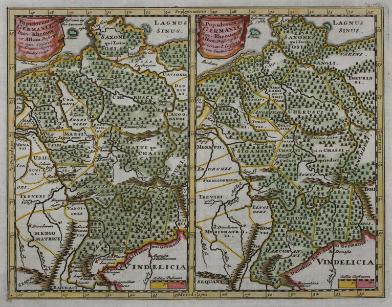
A double map depicting Roman Germany. Showing the region between the Rhine and Elbe Rivers, and including parts of Denmark, Switzerland and Austria. The maps depict Germany under Caesar and Trajan and highlight the differences in political boundaries, place names, and other minor differences during the two stages in German history. Forests and mountains are depicted in detail along with the inclusion of rivers, towns and cities. From Cluver's 'Introductionis in Universam Geographiam tam veterem quam novam Libri'. Philip Cluver (1580-1622) was born in Danzig and after studying at Leyden and Oxford, he became interested in modern and historical geography. His subsequent publications made a wide and influential contribution to knowledge of the subject. Philip Cluver's 'Introductonius' was a popular geography book, first published in 1624 without maps. There were many editions throughout the 17th and 18th centuries with maps from several sets of plates. |
| Framing | unmounted |
| Price | £100.00 |
| Stock ID | 45722 |