
| Method | Copper engraved with hand colour |
| Artist | Cluver, Philipp |
| Published | [London, c.1712 |
| Dimensions | 200 x 252 mm |
| Notes |
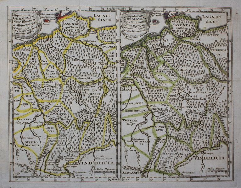
A double map of Roman Germany, from an early eighteenth century printing of Philipp Cluver's 'Introductionis in Universam Geographiam. The maps shows the region between the Rhine and Elbe Rivers, and includes parts of Denmark, Switzerland and Austria, highlighting the differences in political boundaries, place names, and tribal territories, in the Imperial period (Augustus to Trajan), and at the time of Julius Caesar. Forests and mountains are depicted in detail along with the inclusion of rivers, towns and cities. Philip Cluver (1580-1622) was born in Danzig and after studying at Leyden and Oxford, he became interested in modern and historical geography. His subsequent publications made a wide and influential contribution to knowledge of the subject. Philip Cluver's 'Introductonius' was a popular geography book, first published in 1624 without maps. There were many editions throughout the 17th and 18th centuries with maps from several sets of plates. Condition: Vertical folds as issued. Minor time toning, particularly to edges of sheet. Blank on verso. |
| Framing | unmounted |
| Price | £80.00 |
| Stock ID | 48834 |