
| Method | Copper engraved |
| Artist | Bertius, Petrus |
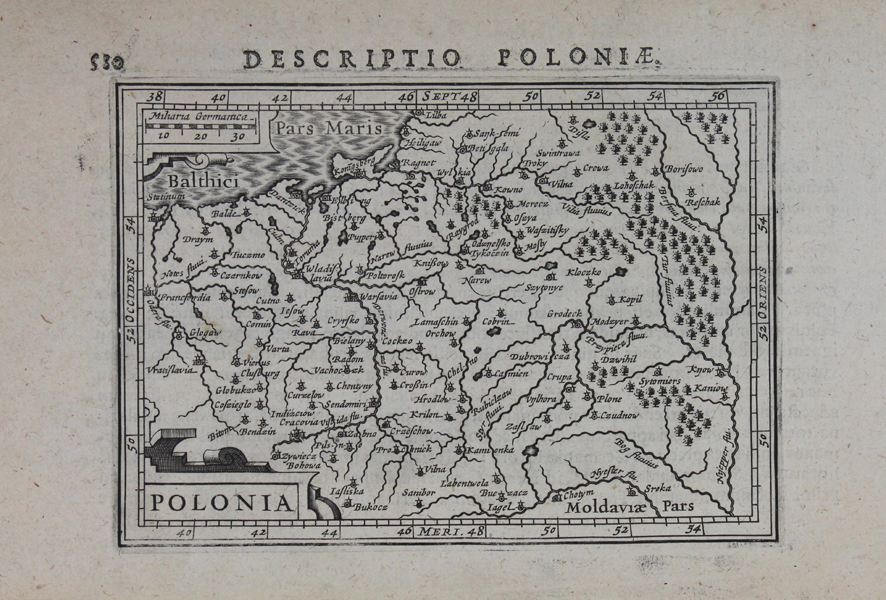
| Published | [Amsterdam, c.1616] |
| Dimensions | 91 x 129 mm |
| Notes |
A miniature map of Poland from a Latin edition of Petrus Bertius' Tabularum geographicarum contractarum. On the bottom left, the title is enclosed in a decorative cartouche. Beautiful detailing with the inclusion of notable towns, forests and rivers. The majority of the plates for Petrus Bertius' Tabularum geographicarum contractarum libri septem were reduced versions of those published in the Mercator-Hondius Atlas Minor. The first edition, published by Cornelis Claes, was published in Amsterdam in 1600, using a suite of miniature maps first published in the Caert-Thresoor by Barent Langenes. Over the next fifty years, the Bertius atlas was issued numerous times in Latin, French, and German, its collection of maps continually increasing with new plates, the majority of which were engraved by Bertius' brothers-in-law Jodocus Hondius and van den Keere. Hondius the Younger's first issue of the Bertius atlas, published in 1616, was an immediate commercial success, and the second edition appeared later the same year. Petrus Bertius (14th November 1565 – 13th October 1629) was a Flemish theologian, historian, geographer and cartographer and was related to Jodocus Hondius Sr. and Pieter van den Keere by marriage. Bertius studied at the University of Leiden and later traveled in Germany and Russia. In 1620 he emigrated to France where he was appointed as a cosmographer to the court Louis XIII. Bertius published a number of folio maps, but never published an atlas of his own. His maps were either separately published or included in atlases and books by other publishers. Condition: Excellent impression. Slight time toning. Latin text on verso. |
| Framing | mounted |
| Price | £275.00 |
| Stock ID | 43150 |