
| Method | Copper engraved |
| Artist | [Anonymous] |
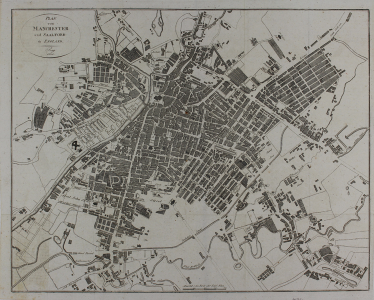
| Published | Prag 1810. |
| Dimensions | 355 x 440 mm |
| Notes |
An early nineteenth century German city map of Manchester and Salford, most likely engraved for one of the numerous volumes of the Neueste Länder- und Völkerkunde, a German primer featuring articles of geographical and ethnographic interest. Streets are given their names in English, but other features, such as rivers, churches, and 'Arbeits-Häuser' are rendered in German. Condition: Vertical and horizontal folds as issued. Text offsetting to bottom right corner of sheet. Blank on verso. |
| Framing | unmounted |
| Price | £150.00 |
| Stock ID | 48595 |