
| Method | Steel engraved with hand colour |
| Artist | Le Keux, John after Fisher, J |
| Published | Published April 1st 1837 by J.H. Parker, Oxford: C. Tilt, Fleet Stt. London & J. Le Keux, Harmondsworth |
| Dimensions | 147 x 190 mm |
| Notes |
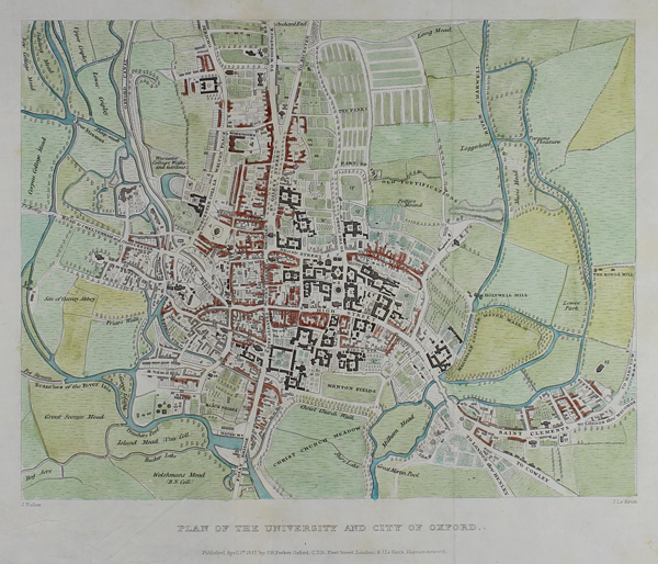
Detailed hand coloured plan of Oxford plotting the city from Jericho in the north to Folly Bridge in the south, the Cowley Road and the Plain in the east to the site of Osney abbey in the west. From "Memorials of Oxford. Historical and Descriptive Accounts of the Colleges, Halls, Churches and other Public Buildings." by James Ingram and John Le Keux. John Le Keux (1783-1846) was an engraver who was involved in several topographical books including the companion work Memorials of Cambridge, whilst the artist Frederick Mackenzie (1787-1854) was a watercolour painter and architectural draughtsman who made drawings for Ackermann's University of Oxford and Public Schools, and twenty-four of the Oxford Almanacs between 1821-1853. |
| Framing | mounted |
| Price | £130.00 |
| Stock ID | 49724 |