
| Method | Copper engraved with hand colour |
| Artist | Neele, Samuel John |
| Published | S.I. Neele sculpt. 352, Strand, London [c.1830] |
| Dimensions | 140 x 190 mm |
| Notes |
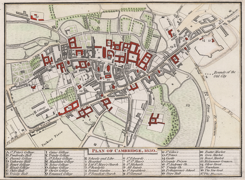
A small-scale city map of Cambridge, originally engraved by Neele for the 1796 edition of John Deighton's A description of the University, Town, and County of Cambridge, but revised numerous times for subsequent editions. This example, a posthumous printing, shows the city in 1830 with notable additions from the first printing including Parkers Piece and Downing College. Colleges and public buildings are picked out in red, and the rest of the map is further embellished with hand colour. Below the plan, an alphanumeric key identifies colleges, churches, and other key landmarks. Samuel John Neele (1758-1824) headed a family of engravers and publishers mainly working from 352 Strand, London. He worked on numerous publications throughout his lifetime trading with his younger brother George as "S. & G. Neele" from 1813 to 1814, and with his son, James as "Neele and Son" from 1816 to 1824. Condition: Trimmed to platemark at top and bottom, as issued. Patches of adhesive tape from old mount to verso, otherwise blank. |
| Framing | unmounted |
| Price | £75.00 |
| Stock ID | 51539 |