
| Method | Steel engraved with hand colour |
| Artist | Monin, Charles V. |
| Published | Dresse par Monin. Grave par Laguillermie et Ramboz. [Paris, c.1838] |
| Dimensions | 195 x 140 mm |
| Notes |
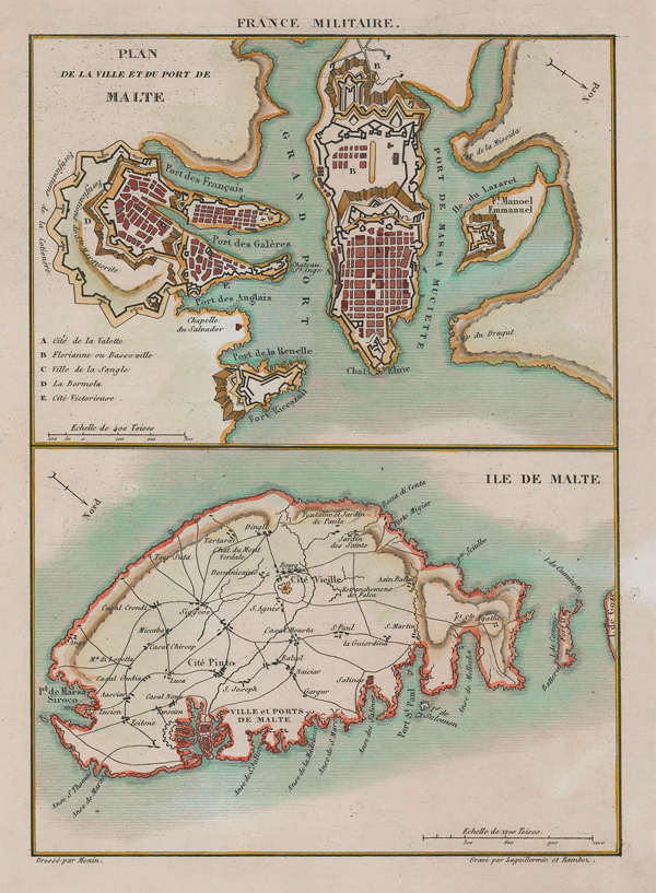
A pair of maps on a single plate depicting the city of Valetta and the island of Malta, from 'France militaire, Histoire des armées françaises de terre et de mer, de 1792 à 1837.' This work of military history, featuring numerous maps, battle plans, and illustrative plates, was written by Abel Hugo, the older brother of the poet and novelist Victor Hugo. At top, a city plan of Valetta provides a view of the grid-pattern of its streets, as well as the various forts, fortifications, harbours, and ports. Below, a general map of Malta features the island's roads, towns, and topography, with the footprints of Mdina and Valetta shown in detail. The map also includes Comino and part of Gozo. Charles V. Monin (fl. c.1830-c.1880) was a nineteenth century French cartographer and publisher working in Paris and Cean. He was a member of the 'Société de Géographie' in Paris and published a number of maps and atlases including 'The Small National Atlas of the departments of France and its colonies' of 1835, 'The Universal Atlas of Ancient, Medieval and Modern Geography' of 1838/9, and the 'Globe' of 1875. Condition: Printers' crease to top margin, not affecting image. Minor tears to edges of sheet. Blank on verso. |
| Framing | unmounted |
| Price | £150.00 |
| Stock ID | 52004 |