
| Method | Chromolithograph |
| Artist | Exsteen, G. |
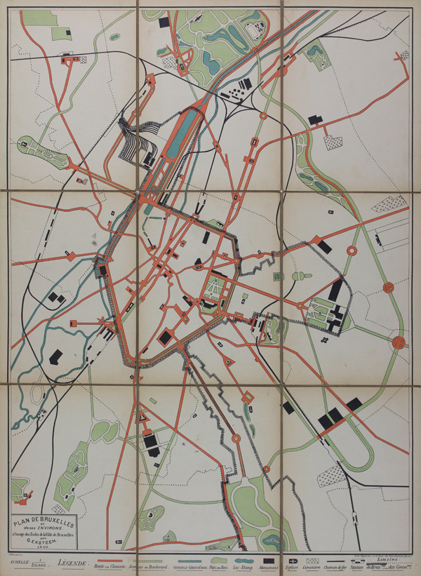
| Published | par G. Exsteen 1907. A. Verwest sc. Lith Falk fils, 15-17 Rue du Parchemin, Bruxs. [Brussels, 1907] |
| Dimensions | 505 x 365 mm |
| Notes |
A rare and graphic early twentieth century folding street-map of Brussels, designed by a G. Exsteen and published by the Brussels based lithographers Falk et Fils. The map features a bold orange, green, and blue colour-scheme, though is relatively simple in terms of cartographic detail, showing only the major roads and avenues of the Belgian capital. Monuments and important public buildings are shown in black, as are churches, cemeteries, and railways. Parks and waterways are also prominently shown. Condition: Dissected and backed on brown linen as issued. Some time toning to edges of each panel, with minor splitting and wear to linen on folds. Blank on verso. |
| Framing | unmounted |
| Price | £95.00 |
| Stock ID | 48688 |