
| Method | Steel engraved with original hand colour |
| Artist | Pigot, James |
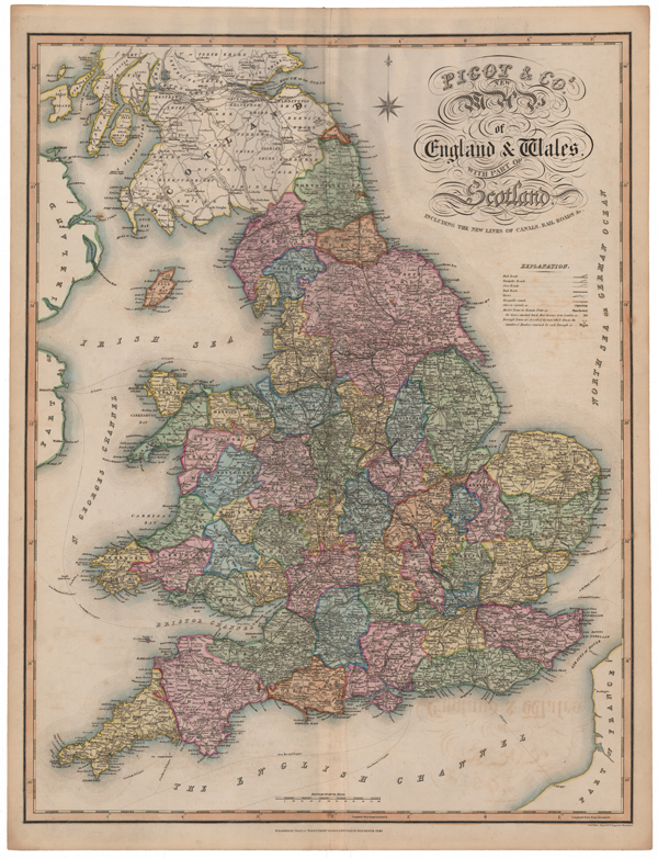
| Published | Published by Pigot & Co. Fleet Street, London, & Fountain St, Manchester, 1840. Steel Plate. Pigot & Co Engravers Manchester. |
| Dimensions | 685 x 525 mm |
| Notes |
A large and decorative nineteenth century map of England and Wales, from Pigot's British Atlas. The counties are presented in full original hand colour, with parts of Scotland, Ireland, and the Isle of Man outlined in hand colour. A key under the title provides details about the roads system, rivers, canals, and railways. James Pigot (1769-1843) was an English cartographer, engraver, printer, and publisher. He is best known for his series of finely engraved oblong county maps, issued in various National Commercial Directories throughout the 1820s and 1830s, and published collectively as Pigot & Co's British Atlas in 1831. Pigot traded in London with Charles Elkins and Isaac Slater under the names Pigot & Co and Pigot & Slater, while at the same time trading in Manchester in partnership with his son, James Pigot Jnr, under the name Pigot & Son. Condition: Horizontal and vertical folds, as issued. Minor time toning and offsetting. Minor surface creasing. Blank on verso. |
| Framing | unmounted |
| Price | £350.00 |
| Stock ID | 51565 |