
| Method | Copper engraved with hand colour |
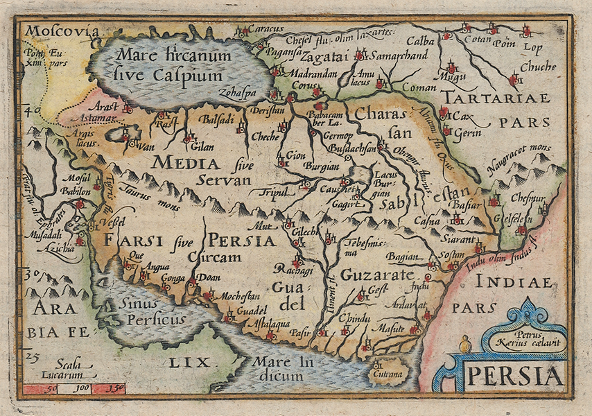
| Artist | van den Keere, Pieter |
| Published | Petrus Kaerius caelavit. [Henry Laurentz, Frankfurt, c. 1610] |
| Dimensions | 85 x 125 mm |
| Notes |
A miniature map of Persia, engraved by Keere for Barent Langenes' Caert-Thresoor. This example, featuring French verso text, as well as the addition of latitude marks along the left border, likely came from the 1610 printing of the Thrésor de chartes, printed by Henry Laurentz in Frankfurt. This example is subtly different from the version of Keere's plate of the same name that appears in the collection of maps in John Speed's A Prospect of the Most Famous Parts of the World, generally referred to as 'miniature Speeds.' Pieter van den Keere, also known frequently as Petrus Kaerius, came to England in 1584, as a Protestant refugee from his home town of Ghent with his sister Colette, who married Jodocus Hondius, in 1587. It was probably from Hondius that Keere learned to engrave. Both engravers left London in 1593 to settle in Amsterdam. His first set of miniature maps were produced for the Middelburg publisher Cornelis Claesz, for inclusion in Barent Langenes' Caert Thresoor. Keere began to engrave a series of miniature maps in 1599 in preparation for a small atlas of the British Isles. The maps were first published in 1617 by William Blaeu with plate numbers and Latin text. They then passed to George Humble, who published them in 1619 and then again in 1627, by which time they had become known colloquially as 'Miniature Speeds.' Barent Langenes (fl. 1597/1598) was a Dutch bookseller and publisher. Little is known about his life and work, apart from his publication of 'Caert-Thresoor' in Middelburg in 1598. The atlas was for sale at Cornelis Claesz's shop in Amsterdam, and was later republished by Claesz, without the Langenes name. The atlas was published by several publishers in different languages between 1598 and 1650 and became quite popular this way. Today the Langenes atlas is mostly associated with Petrius Bertius, who published the first Latin edition in 1600 under the title 'Tabularum Geographicarum Contractarum'. Condition: French letterpress text on verso. Light verdigris from old colour to verso. |
| Framing | |
| Price | £200.00 |
| Stock ID | 53141 |