
| Method | Lithograph |
| Artist | Weller, Edward |
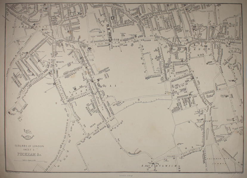
| Published | Weekly Dispatch, 139 Fleet St. Drawn & Engraved by Edwd. Weller, F.R.G.S. Red Lion Square [c.1861] |
| Dimensions | 315 x 438 mm |
| Notes |
A lithographed map of Peckham, Sheet 5 of the Suburbs of London series from The Weekly Dispatch. The map is highly detailed, down to the shape and situation of individual buildings and houses, and encompasses the area of Peckham, Camberwell, Denmark Hill, and East Dulwich. Pubs, Schools, Churches and Chapels, the Camberwell workhouse, and the Lambeth County Court are all labelled, and the London, Chatham, and Dover Railway runs along the top left corner of the sheet. Between 1857 and 1863, the British newspaper The Weekly Dispatch published a series of maps. Over 100 maps were produced, and in 1863, the maps were gathered together to form The Dispatch Atlas. The atlas contained county and country maps, as well as several city maps. Each of the maps featured a distinctive image of a half-globe with a winged mercury above. Edward Weller, FRGS (d.1884) was an engraver, publisher and cartographer. He had premises in London at 34, Red Lion Square (1861) and Duke Street, Bloomsbury (1872). He often worked for George Philip and Son, and William Collins, Sons, & Co. Many of his maps were included in student atlases. Weller's business was continued by his wife Mary Anne (d.1887) and his son Francis Sidney (d.1910). Condition: Pressed hentral horizontal fold. Minor time toning to edges of sheet. Blank on verso. |
| Framing | unmounted |
| Price | £125.00 |
| Stock ID | 49105 |