
| Method | Zincograph with hand colour |
| Artist | [Anonymous] |
| Published | [Zincographed under the Superintendence of Lt. Col. Parsons R.F.F.R.S. at the Ordnance Survey Office, Southampton. Lieut. General J. Cameron R.E. C.B. F.R.S. Director General.] 1875 |
| Dimensions | 635 x 935 mm |
| Notes |
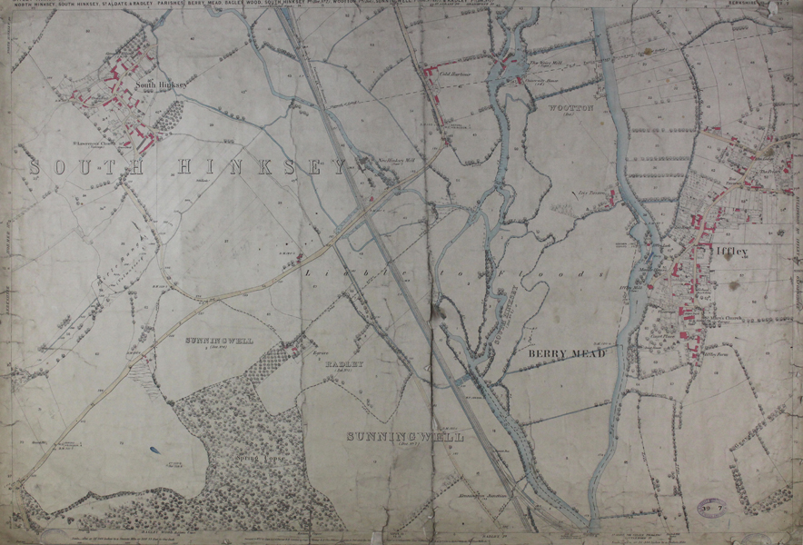
An Ordnance Survey map depicting part of South Oxford, focusing on the part where the River Thames splits of into the Hinksey Stream and towards Iffley Meadows, covering Iffley village, Iffley Lock and the Isis Tavern now know as the Isis Farmhouse, as well as South Hinksey. This map measures 25 x 38 inches, and uses a scale of 1:2500 inches. Inscription to bottom centre: "Surveyed in 1875 by Capt. L.J.G. Ferrier. R.E. Levelled by Capt. W. Wynne R.E. (...) made on Buildings, Walls &c." Ordnance Survey or "OS" is the national mapping agency of Great Britain. The agency provides the most recent and accurate geographic data of Great Britain to the government, businesses and individuals. It was officially founded in 1791, but has even earlier roots. The government first ordered the department of Defence to map the Scottish Highlands after a rebellion took place there in 1745. When the French Revolution started, a survey of the English south coast was ordered. These first surveys were meant to support strategic military planning. William Roy (1726 - 1790), an engineer who worked for the government on these first surveys, became convinced that accurate mapping of Great Britain in its entirety was needed. His vision greatly influenced the foundation of the Ordnance Survey. Between 1842 and 1893, the entire country was surveyed, and would be revised every twenty years. During the 1850's, there was a debate about the most efficient scale to use for ordnance maps, better known as the "Battle of the Scales". The scale of 25 inches to the mile became the standard scale used to map urban as well as rural areas from 1855 onwards, and is still used today. The less detailed scale of six inches to the mile were used only for some uncultivated rural areas, moorlands or mountainous areas. Ex. Col.: Oxford Corporation W.H. White, Engineer. City's Engineer Department. Local Board. Condition: Laid to linen sheet with dark green edge binding. Overall surface dirt built-up. Overall creasing, and tearing to centre fold and edges of sheet. Damage to bottom margin, inscription not entirely legible. |
| Framing | unmounted |
| Price | £175.00 |
| Stock ID | 46657 |