
| Method | Zincograph with hand colour |
| Artist | [Anonymous] |
| Published | Zincographed and Published at the Ordnance Survey Office, Southampton. 1878. [1887 impression] |
| Dimensions | 1055 x 720 mm |
| Notes |
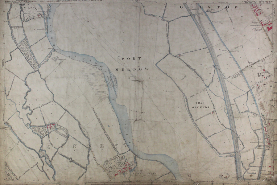
Surveyed in 1876. Re-zincographed and printed in 1882. L.G.B. Orders-Corrections, 1887. An Ordnance Survey map of North-West Oxford, covering Binsley from The Perch to the Godstow Nunnery, Port Meadow, the Oxford Canal and part of Woodstock Road with St Edwards Road. Ordnance Survey or "OS" is the national mapping agency of Great Britain. The agency provides the most recent and accurate geographic data of Great Britain to the government, businesses and individuals. It was officially founded in 1791, but has even earlier roots. The government first ordered the department of Defence to map the Scottish Highlands after a rebellion took place there in 1745. When the French Revolution started, a survey of the English south coast was ordered. These first surveys were meant to support strategic military planning. William Roy (1726 - 1790), an engineer who worked for the government on these first surveys, became convinced that accurate mapping of Great Britain in its entirety was needed. His vision greatly influenced the foundation of the Ordnance Survey. Ex. Col.: Oxford City Council, Engineers Dept. Condition: Laid to linen sheet with green edge binding, time toning to sheet, creases to centre and edges. Bears Oxford Corporation W.H. White Engineer stamp. |
| Framing | unmounted |
| Price | £175.00 |
| Stock ID | 46590 |