
| Method | Copper engraved |
| Artist | Kitchin, Thomas |
| Published | c. 1786 |
| Dimensions | 202 x 168 mm |
| Notes |
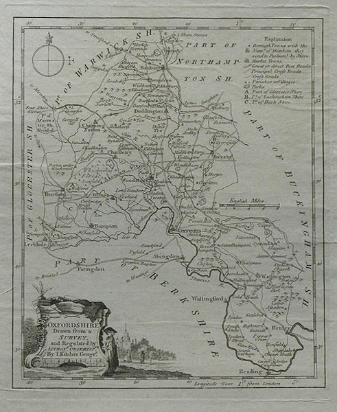
An eighteenth century map of Oxfordshire, with notable towns depicted as well as geological landmarks such as hills and rivers. It also features a decorative cartouche surrounding the title, ornamented with symbols of academic life. Thomas Kitchin (1718-1784) was one of the best and most prolific engravers of the eighteenth century. He issued The General Atlas, Describing the Whole Universe , first published in 1773, and regularly reissued thereafter. His work also included a large number of maps of the English counties, particularly for the London Magazine (1747-1760), the Universal Magazine (1747-1766), and for Dodsley's England Illustrated (1764). Other maps were published in conjunction with Emanuel Bowen in the Large English Atlas and the Royal English Atlas (1763). |
| Framing | unmounted |
| Price | £70.00 |
| Stock ID | 4480 |